 LANDSCAPE AND ENVIRONMENT
Introduction | Research | People | Tools
 LANDSCAPE AND ENVIRONMENT
Maanmittaushallituksen arkisto A: 90 Raisio 5/7.
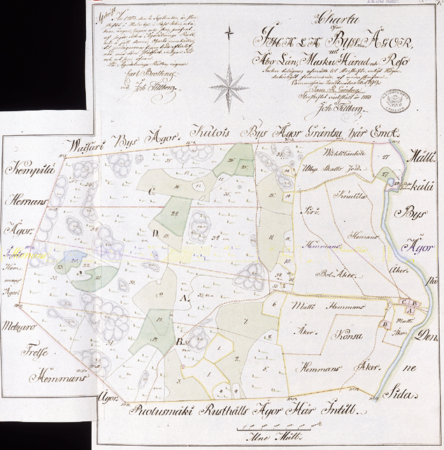
1803 - IHALA VILLAGE MAP
Sami Raninen
The «general parcelling» has been finished: the fields of a farm are no more divided into thin strips residing here and there. On the contrary, each farm has now 1 or 2 big field parcels and some smaller fields. Also the forest and meadow area west of the fields has now been parcelled into segments for the farms. On the map, A stands for Mulli, B for Siiri, C for Knuuti (Nuutila) and D for Konsa farm and their forest divisions, respectively. In the upper right corner of the map you can see the Huhkonkoski Rapids water mill (Reso Qwarn) and taxable outlying areas of Vihtilänpyöli (Wichtilänböle Utbys Skatts jord).
Introduction | Research | People | Tools